 BGS Hosted Metadata
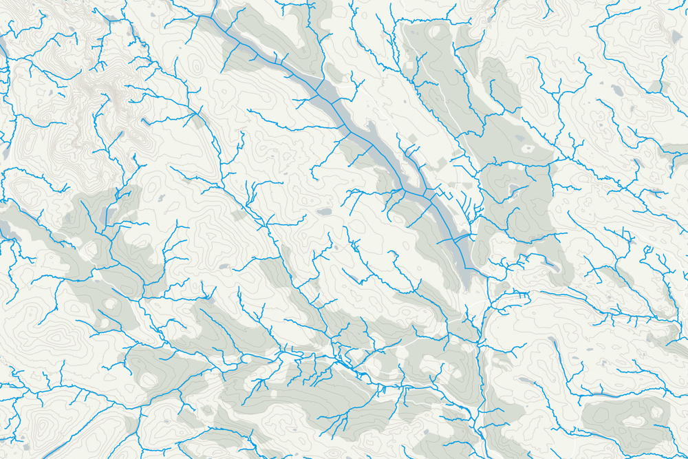
OS Open Rivers
OS Open Rivers GIS data contains over 144,000 km of water bodies and watercourses map data. These include freshwater rivers, tidal estuaries and canals.
Understand how water bodies and watercourses in Great Britain join up.
OS Open Rivers provides a comprehensive datset of Great Britain's River Network, which approximately indicates the central alignment of the watercourse. Inland and tidal rivers are represented by a series of connected link and node features which are assigned with river name and flow direction.
Simple
- Date (Publication)
- 2015-03-23
- Date (Revision)
- 2020-10
- Citation identifier
- https://os.uk / OS Open Rivers
- Point of contact
-
Organisation name Individual name Electronic mail address Role Ordnance Survey
Publisher
- Maintenance and update frequency
- Biannually
- Keywords
-
-
GEMET - Concepts, version 2.4
-
-
tidal water
-
watercourse
-
flow
-
river
-
- Access constraints
- Other restrictions
- Other constraints
- no limitations on access
- Use constraints
- Other restrictions
- Other constraints
- Open Government Licence: attribution required
- Other constraints
-
Please acknowledge the copyright and the source of the data by including the following attribution statement:
Contains OS data © Crown copyright and database right 2021
- Spatial representation type
- Vector
- Denominator
- 25000
- Language
- English
- Character set
- UTF8
- Topic category
-
- Inland waters
- Geographic identifier
- Great Britain
))
- Begin date
- 1880 Before
- End date
- 2020-10
- Reference system identifier
- http://www.opengis.net/def/crs/EPSG/0/27700
- Distribution format
-
Name Version GML
3.2
ESRI Shape
GeoPackage
- OnLine resource
-
Protocol Linkage Name https://os.uk/opendatadownload/products.html WWW:LINK-1.0-http--link
https://www.ordnancesurvey.co.uk/documents/product-support/user-guide/os-open-rivers-user-guide.pdf OS Open Rivers User Guide
WWW:LINK-1.0-http--link
https://api.os.uk/downloads/v1/products/OpenRivers/downloads?area=GB&format=ESRI%C2%AE+Shapefile&redirect Shapefile download
null
https://api.os.uk/downloads/v1/products/OpenRivers/downloads?area=GB&format=GML&subformat=3&redirect GML download
null
https://api.os.uk/downloads/v1/products/OpenRivers/downloads?area=GB&format=GeoPackage&redirect GeoPackage download
WWW:LINK-1.0-http--link
https://osmetadata.astuntechnology.com/geonetwork/srv/api/records/7987ab75-4f5a-4799-81b3-a9f747ee291e OS Download API
- Hierarchy level
- Dataset
Conformance result
- Title
-
Commission Regulation (EU) No 1089/2010 of 23 November 2010 implementing Directive 2007/2/EC of the European Parliament and of the Council as regards interoperability of spatial data sets and services
- Date (Publication)
- 2010-12-08
- Explanation
-
This data conforms except in that it is only available in British Natioanl Grid. We have extended the INSPIRE WatercourseLink feature with four additional attribute, including a simplified approach to providing distinctive names.
- Pass
- No
- Statement
-
OS Open Rivers is a generalised product which has been automatically derived from Ordnance Survey large scale data. The nominal usage scale is 1:25 000, with a recommended viewing scale range of 1:15 000 to 1:30 000.
Metadata
- File identifier
- 4695c100-c8c7-11e4-8731-1681e6b88ec1 XML
- Metadata language
- English
- Hierarchy level
- Dataset
- Date stamp
- 2024-06-11T14:36:28.972904Z
- Metadata standard name
-
ISO 19115:2003/19139
- Metadata standard version
-
1.0
- Metadata author
-
Organisation name Individual name Electronic mail address Role Ordnance Survey
Point of contact
)))