 BGS Hosted Metadata
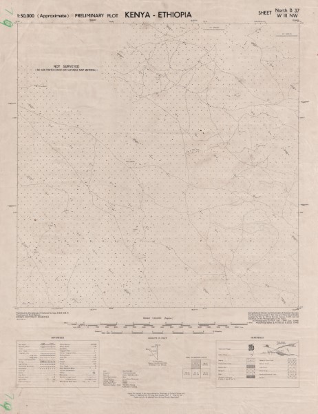
B37 W III NW North Kenya Ethiopia
The Preliminary Plot 1: 50 000 scale map serises are the initial topographic maps developed for Kenya. They are nbased on air photographs captured by the Royal Air Force (United Kingdom). They are essentially black an dwhite maps showing a simple interpretation of the key topographic features. CRS: Transverse Mercator, Clarke 1880. Publishers: DCS Directorate of Colonial Surveys (United Kingdom Government); KS Kenya Survey; GSGS War Office (United Kingdom Government); DOS Directorate of Overseas Surveys (United kingdom Government)
Except map A37 VI SW South Ndakathima which is in Arc (1960) Clarke (1880)
Simple
- Date (Publication)
- 1949
- Edition
-
1
- Presentation form
- Digital map
- Collective title
-
Preliminary Plot (1: 50 000 scale) topographic Maps.
- Status
- Completed
- Point of contact
-
Organisation name Individual name Electronic mail address Role Author Directorate of Colonial Surveys (United Kingdom Government)
Publisher Ministry of Petroleum and Mining (National Geodata Centre for Kenya)
Custodian Ministry of Petroleum and Mining (National Geodata Centre for Kenya)
Point of contact Owner
- Maintenance and update frequency
- Not planned
- Keywords
-
-
Topography
-
50k
-
- Use limitation
-
Internal Only
- Access constraints
- Other restrictions
- Other constraints
-
Internal Only
- Other constraints
- No specifed conditions apply
- Denominator
- 50000
- Language
- English
- Topic category
-
- Imagery base maps earth cover
- Description
-
Geographic area not described
))
- Supplemental Information
-
{"Translation Needs":"",
"Number of pages (Hardcopy)":"",
"Archive Location (Hardcopy)":"",
"Location in Archive (Hardcopy)":"",
"Risk and Impact":"",
"Vital asset to the organisation?":"",
"Current Asset Volume":"5.55",
"Digitalizing status":"Scanned & Georeferenced",
"Scanned Date":"",
"Name of Staff Scanning":"",
"Digital Asset location":" http://gdcs1.gdc.com/SpatialData/Raster/Topographic/Scale_1_50000_Preliminary_Plot/B37_W_III_NW_North_Kenya_Ethiopia.jpg",
"Retention period":"",
"Shared with":"",
"Comments":""}
- Distribution format
-
Name Version .jpg
- OnLine resource
-
Protocol Linkage Name http://gdcs1.gdc.com/SpatialData/Raster/Topographic/Scale_1_50000_Preliminary_Plot/B37_W_III_NW_North_Kenya_Ethiopia.jpg B37 W III NW North Kenya Ethiopia
- Statement
-
Most of the maps in the Preliminary Plot 1: 50 000 series are first version maps which have no been subsequently revised or re-issued. There are however a small number which have been updated and re-released. Where this is the case the version held by the Geodata Centre is shown.
Metadata
- File identifier
- 79a839c7-845b-46f3-971a-f4159edab866 XML
- Metadata language
- English
- Parent identifier
-
Preliminary Plot (1: 50 000 scale) topographic Maps.
Preliminary Plot (1: 50 000 scale) topographic Maps.
- Hierarchy level
- Dataset
- Date stamp
- 2019-10-22
- Metadata standard name
-
National Geodata Centre for Kenya Schema
- Metadata standard version
-
1.0
- Metadata author
-
Organisation name Individual name Electronic mail address Role Ministry of Petroleum and Mining (National Geodata Centre for Kenya)
enquiries
Point of contact
)))
