 BGS Hosted Metadata
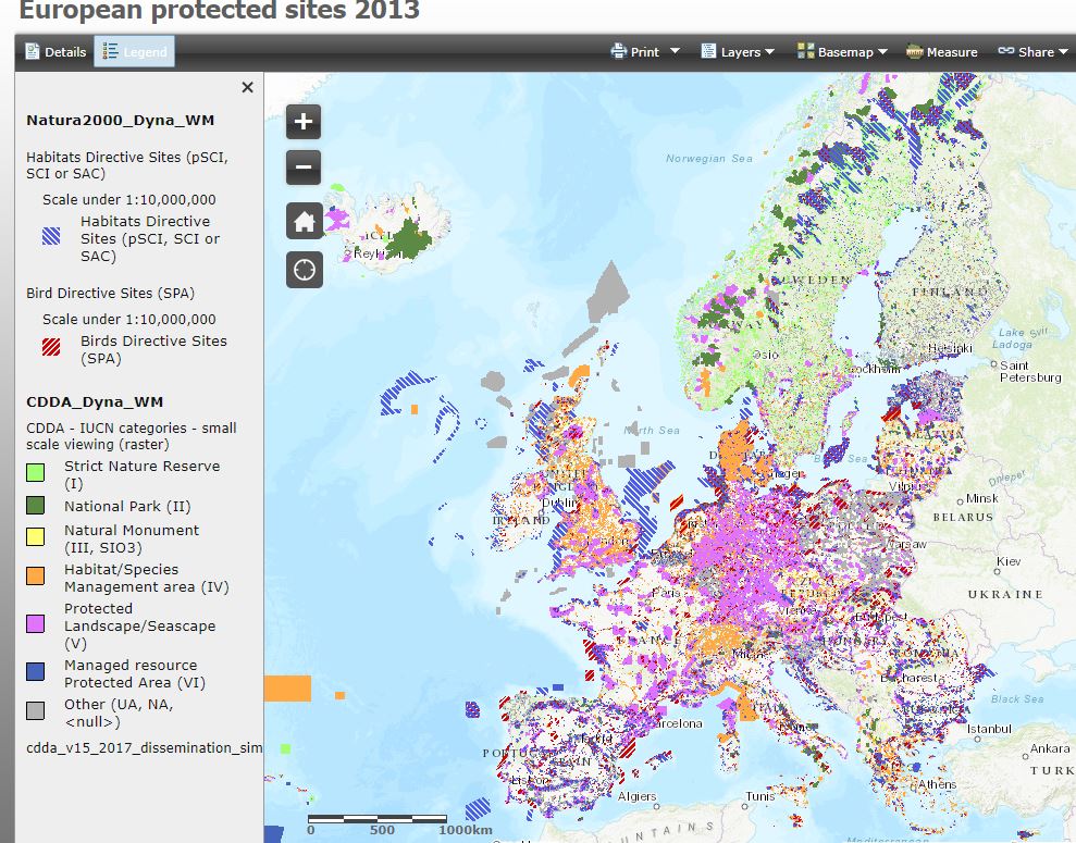
European protected sites 2013
This overview map is a colour-coded interactive viewer of protected sites (Natura 2000 sites and nationally designated areas (CDDA)) across the European Union.
Website:
http://maps.eea.europa.eu/EEABasicViewer/v3/index.html?appid=07661dc8a5bc446fafcfe918c91a1b1b
Simple
- Date (Creation)
- Date (Publication)
- Date (Revision)
- Citation identifier
-
https://www.mica-project.eu/
/
MICA_B1-20
MICA WP3 2017-10-04T18:08:00 Record extracted from Batch 1(b) spreadsheet
- Other citation details
-
No additional information provided about the dataset
- Purpose
-
Purpose for data generation is not known
- Status
- Completed
- Point of contact
-
Organisation name Individual name Electronic mail address Role European Environmental Agency
Resource provider
- Maintenance and update frequency
- Unknown
- dataCentre
-
-
MICA
-
-
MICA ontology (TemporalScheme)
-
-
undefined
-
-
MICA ontology (DataScheme)
-
-
Spatial data / Electronic (Spatial data) (e.g. web portals)
-
- Keywords
-
-
Requirement for data generation: Legal
-
- Keywords
-
-
Method of data or information generation: GIS product
-
-
GEMET Concepts
-
-
Erosion
-
-
GEMET Concepts
-
-
Landscapes
-
-
GEMET Concepts
-
-
Monitoring environmental risk
-
-
GEMET Concepts
-
-
Nature reserves
-
-
GEMET Concepts
-
-
Society
-
-
GEMET Concepts
-
-
Soils
-
-
MICA ontology (DomainScheme)
-
-
European Parliamentary resolutions
-
-
MICA ontology (DomainScheme)
-
-
Local communal by-laws
-
-
MICA ontology (DomainScheme)
-
-
National emission legislation
-
-
MICA ontology (DomainScheme)
-
-
National water legislation
-
-
MICA ontology (DomainScheme)
-
-
Regional/provincial environmental laws
-
-
MICA ontology (DomainScheme)
-
-
UN conventions
-
-
MICA ontology (DomainScheme)
-
-
Designation areas
-
-
MICA ontology (DomainScheme)
-
-
Permitting/Licensing
-
-
MICA ontology (DomainScheme)
-
-
Mineral policy/strategy
-
- Access constraints
- Other restrictions
- Use constraints
- Other restrictions
- Language
- English
- Topic category
-
- Geoscientific information
- Economy
))
- Hierarchy level
- Dataset
- Other
-
Dataset (e.g. an inventory, database or compilation of data)
Conformance result
- Title
-
Data uncertainty
- Date
- Explanation
-
Are any uncertainty measures provided (e.g. standard errors, confidence intervals, etc.)?
- Pass
- No
Conformance result
- Title
-
Quality assurance procedures
- Date
- Explanation
-
Are quality assurance procedures described?
- Pass
- No
Conformance result
- Title
-
Information generation methods
- Date
- Explanation
-
Are data or information generation methods formally described?
- Pass
- No
Conformance result
- Title
-
Record review
- Date
- Other citation details
-
Reviewed by: British Geological Survey
- Explanation
-
Record validation
- Pass
- No
Conformance result
- Statement
-
Organisation source implies that information should be of good quality
Metadata
- File identifier
- 7f52b661-0a7a-4cb7-a164-62e02eebed81 XML
- Metadata language
- English
- Character set
- MD_CharacterSetCode_utf8
- Hierarchy level
- Dataset
- Hierarchy level name
-
dataset
- Date stamp
- 2024-11-07
- Metadata standard name
-
ISO19115
- Metadata standard version
-
2003/Cor.1:2006
- Metadata author
-
Organisation name Individual name Electronic mail address Role British Geological Survey
Point of contact
)))
