 BGS Hosted Metadata
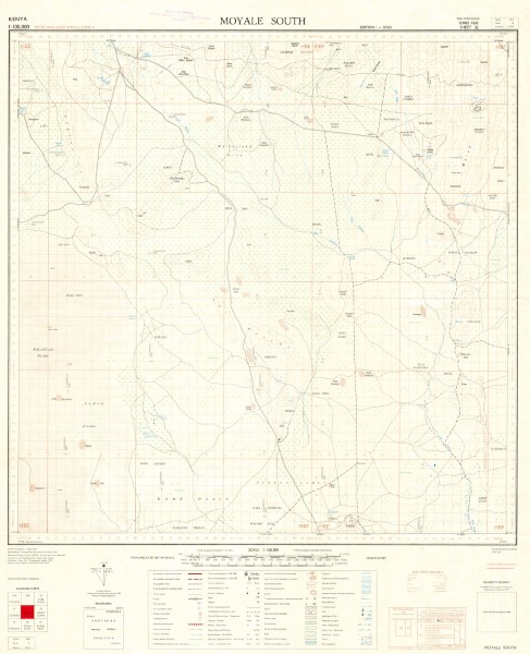
32 Moyale South
Series of 1: 100 000 scale topographic maps pubished between 1958 and 1978. Data was collated and published by War office and Air Ministry (United Kingdom) subsequently Ministry of Defence (United Kingdom)[GSGS]; Survey Kenya [SK]; Directorate of Overseas Surveys for the Kenya Government [D.O.S.] .
Maps are projected using the East African Grids (Transverse Mercator(Clarke 1880); Arc (1960) (Clarke 1880). A small number of the maps are shown as using Arc (1950) (Clarke 1880) however, this dataum is usually used for map in Botswana, Malawi, Zambia and Zimbabwe. The map references for the sheets indicated to be in Arc (1950) (Clarke 1880) have been flagged to indicate this. Publishers: G.S.G.S. British War Office and Air Ministry/Ministry of Defence (United Kingdom); D.O.S. Directorate of Overseas Surveys for the Kenya Government; S.K Survey Kenya
Simple
- Date (Publication)
- 1960
- Edition
-
1
- Presentation form
- Digital map
- Collective title
-
Y633 (1: 100 000 scale) Topographic Map Series
- Status
- Completed
- Point of contact
-
Organisation name Individual name Electronic mail address Role Author Survey of Kenya
Publisher Ministry of Petroleum and Mining (National Geodata Centre for Kenya)
Custodian Ministry of Petroleum and Mining (National Geodata Centre for Kenya)
Point of contact Owner
- Maintenance and update frequency
- Not planned
- Keywords
-
-
Topography
-
100k
-
- Use limitation
-
Internal Only
- Access constraints
- Other restrictions
- Other constraints
-
Internal Only
- Other constraints
- No specifed conditions apply
- Denominator
- 100000
- Language
- English
- Topic category
-
- Imagery base maps earth cover
- Description
-
Moyale area
- Supplemental Information
-
{"Translation Needs":"",
"Number of pages (Hardcopy)":"",
"Archive Location (Hardcopy)":"",
"Location in Archive (Hardcopy)":"",
"Risk and Impact":"",
"Vital asset to the organisation?":"",
"Current Asset Volume":"6.32",
"Digitalizing status":"Scanned",
"Scanned Date":"",
"Name of Staff Scanning":"",
"Digital Asset location":" http://gdcs1.gdc.com/SpatialData/Raster/Topographic/Scale_1_100000_Series_Y633/32_Moyale_South.jpg",
"Retention period":"",
"Shared with":"",
"Comments":""}
- Reference system identifier
- Transverse Mercator, Clarke 1880
- Distribution format
-
Name Version .jpg
- OnLine resource
-
Protocol Linkage Name http://gdcs1.gdc.com/SpatialData/Raster/Topographic/Scale_1_100000_Series_Y633/32_Moyale_South.jpg 32 Moyale South
- Statement
-
The majority of this map series are version 1 copies, a small number have been revised and republished these carry a subsequent version number. No further revisons or republished versions have been identified.
Metadata
- File identifier
- 9a20c9c1-3254-4685-bdb5-84b11df20ecc XML
- Metadata language
- English
- Parent identifier
-
Y633 (1: 100 000 scale) Topographic Map Series
Y633 (1: 100 000 scale) Topographic Map Series
- Hierarchy level
- Dataset
- Date stamp
- 2019-10-22
- Metadata standard name
-
National Geodata Centre for Kenya Schema
- Metadata standard version
-
1.0
- Metadata author
-
Organisation name Individual name Electronic mail address Role Ministry of Petroleum and Mining (National Geodata Centre for Kenya)
enquiries
Point of contact
