 BGS Hosted Metadata
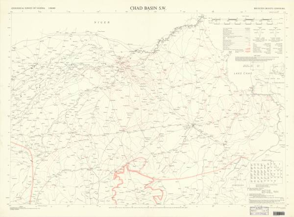
Chad Basin SW Bouguer gravity contours. DOS (Geol) 1136A Scale 1:500,000 (1963)
Simple
- Date (Publication)
- Presentation form
- Digital map
- Collective title
-
Map
- Point of contact
-
Organisation name Individual name Electronic mail address Role Great Britain. Directorate of Overseas Surveys ; Cratchley C.R. ; Geological Survey of Nigeria
Author Directorate of Overseas Surveys
Publisher Custodian Point of contact Owner
- Keywords
-
-
NIGERIA (geophysical nonseries); Bouguer maps & surveys -- Nigeria
-
- Denominator
- 500000
- Language
- English
- Topic category
-
N
S
E
W
))
- Distribution format
-
Name Version
- Statement
-
Map
)))
