 BGS Hosted Metadata
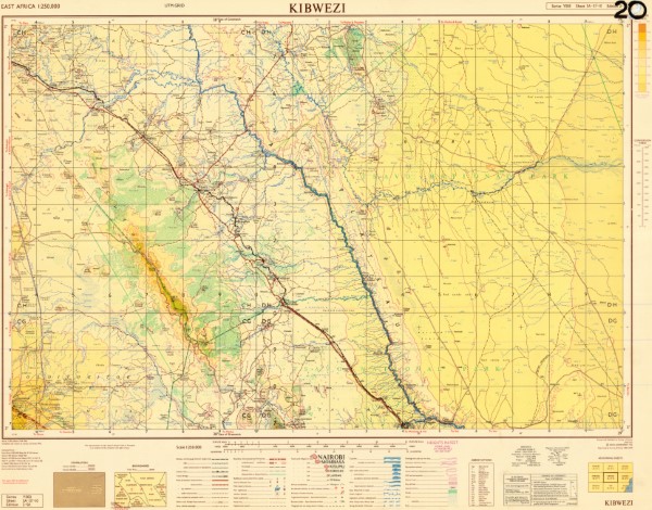
SA 37 10 Kibwezi
Y503 series of 1:: 250 000 scale topographic maps. Each map is a compilation from pre-existing published topographic maps mosty at 1: 50 000 scale (detailed on each map face).
Series includes Kaabong, Aloi, jinja, in Uganda which was compiled and published by The Department of Lands and Surveys in Uganda. These maps use the New Arc (1960) datus Clarke 1880 (Modified) Spheroid UTM zone 36.
Series also includes Musuma in Tanzania which was compiled by the Ministry of Lands, Forests and Wildlife, Tanganyika.
Arusha was compiled by the Ministry of Lands, Settlement and Water Development Tanzania. Lushoto was compiled by the Ministry of Lands Surveys and Water Tanganyika.
Series also include Kapenguria, Nyeri, Chuka, Chismaio, published by War office and Air Ministry using Transverse Mercator, Clarke 1880 (UTM Zones 36 and 37). Garsen was published by the Ministry of Defence (United Kingdom). CRS System: Various: Transverse Mercator, Clarke 1880; Arc 1960 (Clarke 1880); Arc 1960 (Clarke 1880) Zone 36S; Arc 1960 (Clarke 1880) Zone 36N; Arc 1960 (Clarke 1880) Zone 37S; Arc 1960 (Clarke 1880) Zone 37N, Arc 1960 (Clarke 1880) Zone 38N
Simple
- Date (Publication)
- 1966
- Edition
-
2
- Presentation form
- Digital map
- Collective title
-
Y503 (250k) East Africa Topographic Maps
- Status
- Completed
- Point of contact
-
Organisation name Individual name Electronic mail address Role Author Survey of Kenya
Publisher Ministry of Petroleum and Mining (National Geodata Centre for Kenya)
Custodian Ministry of Petroleum and Mining (National Geodata Centre for Kenya)
Point of contact Owner
- Maintenance and update frequency
- Not planned
- Keywords
-
-
Topography
-
250k
-
- Use limitation
-
Internal Only
- Access constraints
- Other restrictions
- Other constraints
-
Internal Only
- Other constraints
- No specifed conditions apply
- Denominator
- 250000
- Language
- English
- Topic category
-
- Imagery base maps earth cover
- Description
-
Kibwezi area
))
- Supplemental Information
-
{"Translation Needs":"",
"Number of pages (Hardcopy)":"",
"Archive Location (Hardcopy)":"",
"Location in Archive (Hardcopy)":"",
"Risk and Impact":"",
"Vital asset to the organisation?":"",
"Current Asset Volume":"7.25",
"Digitalizing status":"Scanned",
"Scanned Date":"",
"Name of Staff Scanning":"",
"Digital Asset location":" http://gdcs1.gdc.com/SpatialData/Raster/Topographic/Scale_1_250000_Series_Y503/SA_37_10_Kibwezi_V2.JPG",
"Retention period":"",
"Shared with":"",
"Comments":""}
- Reference system identifier
- 4210
- Distribution format
-
Name Version .jpg
- OnLine resource
-
Protocol Linkage Name http://gdcs1.gdc.com/SpatialData/Raster/Topographic/Scale_1_250000_Series_Y503/SA_37_10_Kibwezi_V2.JPG SA 37 10 Kibwezi
- Statement
-
This collection has been published fro a number of source (identified in the Description (abstract)). For some maps there have been several editions published. To identify which editions of the maps are available please see the individual map records.
Metadata
- File identifier
- f2d3713e-0651-4004-bf1f-b1271622325d XML
- Metadata language
- English
- Parent identifier
-
Y503 (250k) East Africa Topographic Maps
Y503 (250k) East Africa Topographic Maps
- Hierarchy level
- Dataset
- Date stamp
- 2019-10-22
- Metadata standard name
-
National Geodata Centre for Kenya Schema
- Metadata standard version
-
1.0
- Metadata author
-
Organisation name Individual name Electronic mail address Role Ministry of Petroleum and Mining (National Geodata Centre for Kenya)
enquiries
Point of contact
)))
